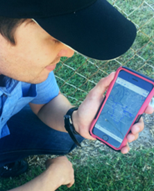
Ecosure has developed a mobile phone mapping product that enables your phone or tablet to work as a mapping device to provide your exact location in relation to vegetation, clearing and cadastral layers (property boundaries).
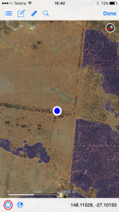
The mobile mapping product works in areas without phone coverage, and shows a map of your location and the vegetation clearing layers, as shown in the picture below. Mapping layers that have been loaded include:
- PMAVs (property maps of assessable vegetation)
- Protected Plants (blue dots) layers
- Clearing permit layers
- Property boundaries
We have tested the application with a number of landholders in different areas on both iphone and android systems, and they have found the app invaluable when carrying out clearing activities. It has also been used to locate property boundaries and new fencelines. The data supplied with the app is compatible with most mapping systems, including Phoenix mapping and QGIS.
For information on mobile mapping products, please contact our Rockhampton office on 07 4994 1000


