Apart from having detrimental economic impacts to the agricultural and industry sectors, the control of declared weeds is legislated under the Land Protection (Pest and Stock Route Management) Act 2002 and some local government pest management plans. This legislation imposes a legal responsibility for control of declared weeds by all landholders on all land under their management, including in some cases the development and implementation of weed/pest management plans. Declared pest plants are targeted for control as they can have serious economic, environmental and social impacts in Queensland. Some Council plans relate to environmental weeds (not declared) which are considered a priority for management within their area.
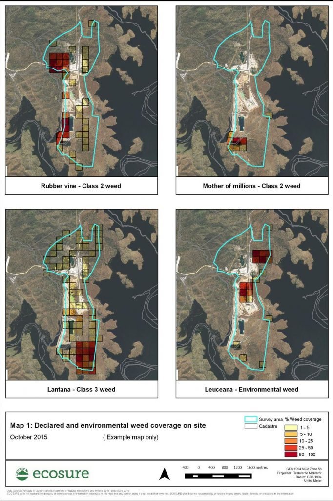
In order to help landholders and business of large properties manage and prioritise their weed control, Ecosure has developed a mapping and surveying process to accurately map the distribution and densities of weeds over the whole property (not just what is seen from access roads). This involves creating a grid layer over a property, then using mobile GIS and remote imagery in the field to determine the species and weed coverage of every grid. The results of a survey are shown in the map below.
This form of survey allows the formation of a weed management plan that effectively:
- identifies all declared and environmental weeds on the land
- identifies significant areas of infestations that can be managed or quarantined to avoid further spread
- provides strategies and treatment options for the identified weeds
- raises alerts for new weeds on the property, so that they can be controlled before they become an issue
- allows the landholder to budget and prioritise weed control over the whole of the property
- allows the monitoring and success of weed control strategies .
Contact: Heather Richards or Geoffrey Sinclair on 07 4994 1000

