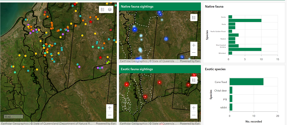
Realtime data collection in action
Real-time data capture in surveys is a powerful tool that has revolutionised the way Ecosure can collect, monitor and report field data. With cloud-based tablet technology, Esri applications such as Field Maps and Survey123 with Ecosure-designed forms, Ecosure can gather data from remote locations more efficiently and accurately than ever before.
This cloud-based data capture system allows senior staff to track people in the field and to see data that is being collected in real time by other team members and office-based staff. It also enables office personnel to rapidly identify any changes or opportunities for additional data gathering. Data gathered using this digital system can be automatically compiled into summary reports that can be viewed through an interactive ArcGIS Dashboard which is a visual analytics tool allowing users to critically evaluate large datasets. This streamlines the reporting process while also providing clients with up-to-date information of the project’s progress. Not only does real time data capture provide Ecosure with a more reliable, accurate and efficient way to collect field data, it also helps to minimise manual entry mistakes and produces detailed reports quickly. It’s this level of innovation that sets Ecosure apart from competitors and demonstrates our commitment to pushing the boundaries of technology gives them an advantage in delivering surveys efficiently, improving accuracy and ensuring all permitting conditions are met without delay.
The advantages of using real time data capture are clear: it is streamlined and efficient, improves accuracy and enhances customer satisfaction by providing them with live updates of the project’s progress. This allows Ecosure to provide an exemplary service that meets customer satisfaction and results in high-quality outcomes.


